

Data to Insight Management Products

High-Performance Computing

Unmanned Aerial Vehicle

Automated Guided Vehicle


Compatibility:
-
A. Infectious Disease
Wf-artic, Wf-mpx,
Wf-flu, Wf-tb-amr -
B. Targeted Sequencing:
Wf-cas9, Wf-Amplicon
-
C. Miscellaneous
wf-pore C, Wf-aav-qc
-
D. Assembly
Wf-clone validation
Wf-Bacterial Genome

Compatibility:
-
A. Metagenomics
Wf-Metagenomics,
Wf-16s -
B. Direct RNA sequencing and cDNA
Wf-transcriptomes,
Wf-Single Cell -
C. Human Genetics
Wf-Human Variation,
Wf-Somatic Variation
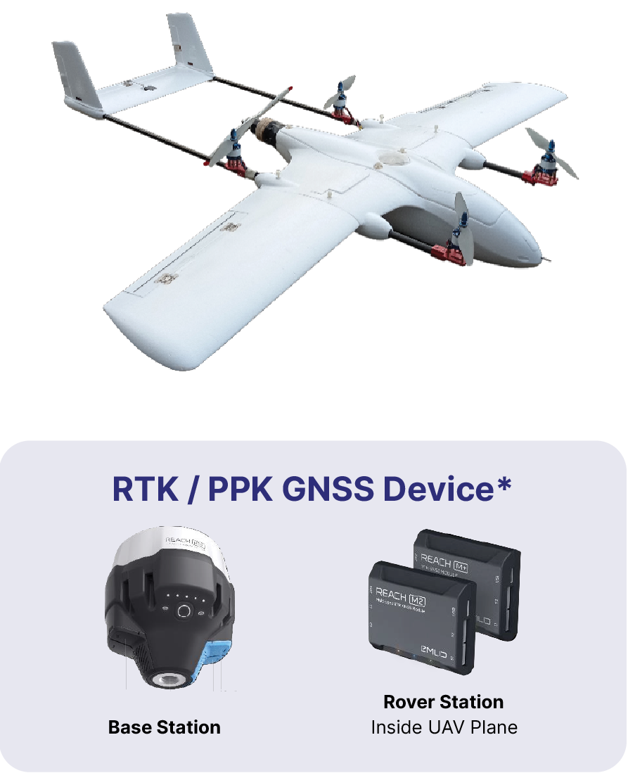
Ready to Fly VTOL UAV
For Large Area Mapping & Long Range Surveillance
- Flight Time with Payload: ~100 Min, Speed: 60 Km/h, Distance: 100 Km
- Mapping Area: 1.000 Ha per Flight*
- Payload Weight: 500 g, Wind Resistance: 35 Km/h .
- Unlimited waypoint navigation fully automated take off, flight & landing
- Pre-flight route created using computer ground station or mobile devices
- Special Features: Terrain Following with Google Elevation Data, Multirotor Assist for Emergency Landing on VTOL, Dual Hybrid Battery Power with Li ion & LiPo on VTOL
- *Optional Not Included: Multi Frequency L1/L2
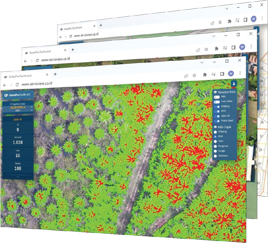
UAV Mapping Service
Better Planning with Aerial Mapping service
- Standard precision map produced by UAV without Ground Control Points are: Horizontal (X, Y Axis): Up to 2 – 5 Meters, Vertical (Z Axis): Up to 5 – 10 Meters.
- High precision map produced by UAV with Ground Control Points are: Horizontal (X, Y Axis): Up to 20 Centimeters, Vertical (Z Axis): Up to 1 Meter.
- Available in Low Resolution and High Resolution.
- Low Resolution: Up to 10 cm per pixel, 1:1000 scale map, 5.000 Ha per day, 50 flights per day
- High Resolution: Up to 1 cm per pixel, 1:100 scale map, 500 Ha per day, 50 flights per day.
- Optional Image Processing: 3D Digital Surface Model & Video fly Special request for Contour Lines Map, Tree Counting, etc are available.
Sampaikan Kebutuhan Riset Anda
Tim advisor spesialis kami sangat antusias mendukung keberhasilan riset dan aplikasi rutin Anda.